

Aska Adventure Area
The Aska Adventure Area—a local favorite—is a hiking-mountain bicycling trail system 17.0 miles in length developed on National Forest lands…
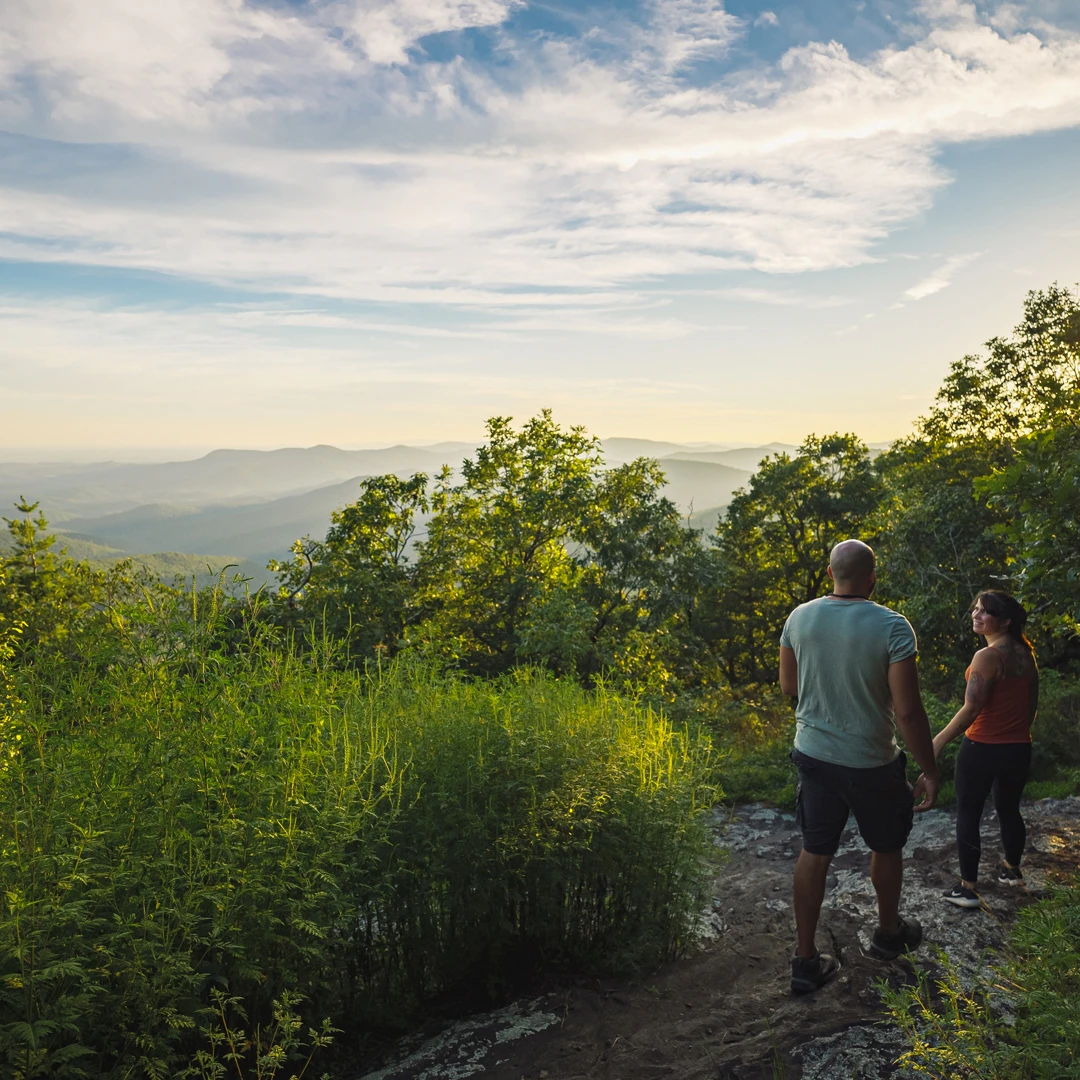
The start of the Appalachian Trail begins at the top of Springer Mountain in southern Fannin County where it begins its 2,000+ mile trek to Maine's Mount Katahdin known as the terminus of the Appalachian Trail.
As the trail follows the eastern ridge of the Appalachian Mountains it passes through 14 states, and although the slogan is "Maine to Georgia," most people hike the trail the other way, Georgia to Maine.
Georgia's mild climate plays a role in this, since hikers like to start the 6 month trek in early March. Another reason: the toughest part of the trail, in New Hampshire and Maine is saved for last, when hikers are in condition to handle it.
Georgia has nearly eighty miles of the AT running from Springer Mountain on the Fannin-Gilmer line to Bly Gap, where the trail enters North Carolina. Some excellent backpacking adventures await those who decide to hike the Georgia portion of this National Scenic Trail.

Access to the starting point of the Appalachian Trail is in southern Fannin County at Springer Mountain. From Blue Ridge, take Aska Road 13.5 miles until it dead ends into Newport Road. Turn right on Newport Road, go 4.5 miles until it dead ends into Doublehead Gap. Turn right on Doublehead Gap and go 2 miles to FS Road 42 (on the left). Turn left and go approximately 6.5 to 7 miles to the parking area on your left. A short hike from the parking lot (across the street) leads to the summit.
A junction of the Appalachian Trail and Benton MacKaye Trail, located on FS Road 58 on Noontootla Creek. You can also start a 3.7 mile hike to Springer Mountain from Three Forks. From Blue Ridge, go south on Aska Road to the end. Turn right onto Newport Road, go 4.5 miles to end. Turn left onto Doublehead Gap Road, cross a concrete bridge, where the road will become dirt/gravel. Continue .3 miles, just past the church and cemetery you will turn right onto dirt/gravel Forest Service Road 58. Drive a scenic 5.3 miles to the Three Forks area. There will be a hikers crossing sign. From here you can hike across the bridge for the 3.7 mile hike to Springer Mountain, the start of the Appalachian Trail.

The trail head is on your left as you drive in, opposite of Noontootla Creek which you will see with the trail bridge crossing it on your right. It starts as a gradual hike alongside Long Creek. There are three short ascents before reaching the blue blazed side trail to the falls, total hike is 1.1 miles.
There are three day-use parking areas covering the Fannin County section of the Appalachian Trail, two on FS 42 (Springer Mountain and Hightower Gap) and on FS 58 at Three Forks.
The Appalachian Trail starts at Springer Mountain in Fannin County and stretches all the way to Maine, the trail is the longest hiking-only trail among the three National Scenic Trails and is the longest hiking-only footpath in the world.
Navigating the Appalachian Trail in Georgia can be quite challenging for hikers, particularly those not used to long-distance hiking or rugged, rocky terrain. Despite these challenges, many hikers find the Georgia section of the Appalachian Trail to be rewarding and full of breathtaking scenic views.
Each year, the Appalachian Trail attracts over 3 million visitors, with more than 3,000 individuals daring to take on the ambitious challenge of "thru-hiking" the entire trail in a single year.
Be prepared for wilderness. Some roads are rough. Please pack in all you will need and pack out all your trash. The rule of the forest is “Leave No Trace.” If you build a fire, never leave it unattended. Use good judgment when hiking, particularly around waterfalls where rocks are often wet, moss covered and slippery. If hiking during hunting season, wear a brightly colored vest. The most effective way to prevent mishaps is to adequately prepare for the trip. Knowledge of the area, weather, terrain, limitations of your body, plus common sense can help to ensure a safe and enjoyable trip.
Aska Adventure Area
The Aska Adventure Area—a local favorite—is a hiking-mountain bicycling trail system 17.0 miles in length developed on National Forest lands…

Benton MacKaye Trail
Blue Ridge is a Benton MacKaye Trail Town.

Chattahoochee National Forest
Fannin County has 106,000 acres of forest, 66,097 in the Blue Ridge Ranger District and 40,006 acres in the Cohutta Wilderness.

Cohutta Wilderness
With more than 40,000 acres in Georgia and Tennessee (where its known as Big Frog Wilderness Area), the Cohuttas comprise…

Swinging Bridge on the Toccoa River
The Toccoa River Swinging Bridge is a 270-foot bridge in Fannin County, Georgia—the longest swinging bridge east of the Mississippi…

Waterfall Hikes
Enjoy our local waterfalls and others nearby.

Waterfalls and Winter Hiking
Have you ever been winter hiking? With all the scenery around Blue Ridge and Fannin County, the time of year…
Big on Beauty, Low on Mileage: Fantastic Hikes under 2 Miles
Some of our favorite spots are tucked deep within remote wilderness areas.

Tips for Hiking with Kids
The Benton Mackaye Trail is a great way to explore hiking with the family. Here is a great guide to…

Winter Fitness Walks & Hikes in Blue Ridge GA
Whether you want the joy of a mountain hike or just a nice walk around a quaint mountain town...

Rack up the miles! Amazing long-distance hikes near Blue Ridge
Lace up your hiking boots and rack up the miles on these amazing long-distance hikes near Blue Ridge.

5 Hikes Under 5 Miles in Blue Ridge
There are a multitude of long day-hike trails in Blue Ridge, but if you want just a touch of Mother…

Spring Drives & Hikes in Blue Ridge
Where can you get out into the beauty of a Blue Ridge Spring? Check out these gorgeous trails and scenic…

A Family Hike to Long Creek Falls on the Appalachian Trail
If you want to impress your kids or grandkids, take them on a hike on the Appalachian Trail to beautiful…
This website uses cookies to optimize your visitor experience. Learn More